Kml
Advertisement
KML Path Measurer v.1. 1. 2001
This application will measure paths in Google Earth, either saved in KML Files, or copied from the clipboard. The application uses the haversine formula to measure distances between points on a spherical object.
Advertisement
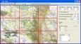
KML Map Server v.0.5
KMLMapServer turns any UMN MapServer installation in a flexible KML vector and raster data server.
Knowledge Markup Language (KML) v.0.3.1
KML is a knowledge base with support of logical modeling.
OkCustomMap v.1.0.0
OkCustomMap is a software to produce Garmin Custom Maps. Supports many map formats, JPEG quality, KML transparency, draw order, image scaling and filters. You can customize the size of the tiles or the tiles number horizzontally or vertically.
ArBa3d v.3. 2. 2001
ArBa3d is a 3D modeling software that allows to create a 3D model from a set of digital photos. The tool takes as input a set of photos taken from different viewpoints.
GSpatial Toolbar v.2. 2. 2004
ESRI shapefiles are a very common mapping or GIS dat exchange format. Google Earth uses an exchange format called KML, which is a variant of XML.
KMLCSV Converter v.2 2
KMLCSV Converter is a free open source software that enables you to convert KML file to a formatted CSV file, and vice versa. This CSV file can then be uploaded into your Garmin GPS by using Garmin POI Loader.
GpRoko v.1.8
Manage your GPS files with this tool. GpRoko (Track Analyzer) takes NMEA logfiles from your GPS device, manages your tracks and exports them as KML to Google Earth. Investigate altitude and speed information, measure distances and cut tracks.
GE-Graph v.2.2.21
GE-Graph (GE-Graph: Graph for GoogleEarth) helps you to make graph into Google Earth to illustrate your presentations, and papers. GE-Graph was developed to generate graphs from kml files saved by GE.
Earth Addresser v.1.0
Earth Addresser takes the addresses from your Address Book and writes them to a 'KML' file which Google Earth can open to display your friends' places right on the map.
UTrekGE v.1.2
Generate an up-down graph for a path in KML file of Google Earth.