Kml
Advertisement
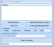
KML Color converter v.2.0
With the help of KML Color Converter you can pick and mix colors and get the respective codes in 7 systems: KML, RGB, VB, HTM, CMY, CMYK and HSL. You can also adjust the transparency of the resulted color.
Advertisement
KML Path Measurer v.1. 1. 2001
This application will measure paths in Google Earth, either saved in KML Files, or copied from the clipboard. The application uses the haversine formula to measure distances between points on a spherical object.
KML Feature Extractor v.1.0.1
KML Feature Extractor is a program designed to extract the features of KML/KMZ files (the native format of Google Earth). The program will scan for features, extract them, and convert them to shapefiles.
KML Map Server v.0.5
KMLMapServer turns any UMN MapServer installation in a flexible KML vector and raster data server.
Knowledge Markup Language (KML) v.0.3.1
KML is a knowledge base with support of logical modeling.
KML Colors v.1.1
Utility for generating hex color value for KML files.

TRIANGULATION for AutoCAD v.2.1
An add-on for AUTOCAD, for the TRIANGULATION of a set of point, isolines, KML creator, the VOLUME of a set of 3dface entities, loading of XYZ points files and sections.
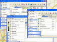
3D Route Builder v.1.3.7.0
3D Route Builder is a strong GPS editor for fine grain control over paths directly in Google Earth. These can then be either built from scratch or based on existing KML/KMZ, GPX or Garmin Training Center TCX.

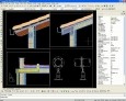
Topography in AutoCAD v.2.3
An add-on for AUTOCAD or BricsCAD, for the TRIANGULATION of a set of point, isolines, KML 2D and 3D creator, the VOLUME of a set of 3dface entities, loading of XYZ points files, surface flatness and sections.
RoboGEO
Geocode photos (including RAW) from a GPS. Stamp the images or write (lossless) to the EXIF headers. Create web pages using Google Maps, export KML/KMZ files to Google Earth, upload to Flickr, export shapefiles (SHP) or AutoCAD DXF files. Supports Garmin
ProgeCAD Professional 2009 DWG CAD
AutoCAD functionality at less than tenth the cost! DWG DXF PDF read write. Similar icons, commands and interface. Raster image embedding, raster-to-vector software included. DWF and Google Earth KML publishing, IntelliCAD AutoLISP interpreter, ACIS 3D